
Search london history from Roman times to modern day
St Faith under St Paul index
Paternoster row is in the Castle Baynard ward, when described by Maitland in his 1756 survey of London.

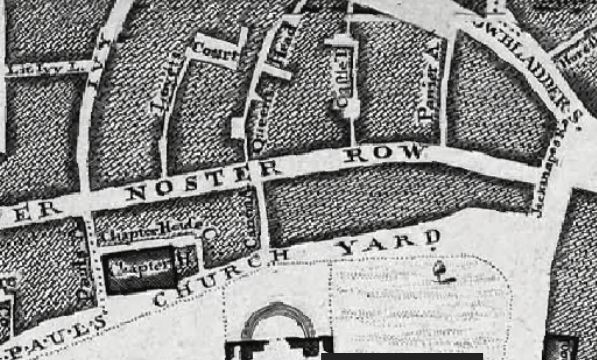
John Rocques map of 1746 lists the Castle Tavern and the Queens Head in Paternoster row.
A listing of historical London public houses, Taverns, Inns, Beer Houses and Hotels in St Faith under St Pauls parish, City of London.
Residents at this address
John Strype Survey of London in 1720 - Farringdon Within Ward and Castle Baynard Ward lists and maps '16 Castle Tavern'.
John Rocques map of 1746 lists the Castle Tavern and the Queens Head in Paternoster row.
John Rocques map of 1799 clearly shows Queens head passage running between Paternoster row northwards to Newgate street.
Trying to avoid privacy and cookie settings overwriting content