
Search london history from Roman times to modern day
Roman London - the London wall
These pages are based on a "Royal Commission On Historical Monuments 1834" - actually it is 1928; which is in the public domain.
A mapping of the area is always good, modern day compared to pre-1900 maps from the NLS site
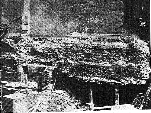
(9) . Roman Wall House. In 1905, on clearing the site of Nos. 18-20 Jewry Street
and No. 1 Crutched Friars, a length of about 40 feet of the inner face of the
wall (Plate 26) was uncovered Its maximum height was 8-9 feet, the base being 8
1/2 feet below the present ground-level. The usual triple levelling-course of
brick was surmounted by four courses of squared rag-stone and a triple
bonding-course, six courses of squared rag-stone and a double bonding-course
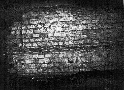
with the usual offsets. A large portion of this fragment is Preserved in the
basement of the modern building.

View of wall as exposed in 1905 - in Roman Wall House

Part of the remains as in 1927, of the town wall, Jewry street and Crutched friars in Roman Wall House
Here is a far better description, than I could ever envisage, with
lots of pictures inside the building, too.
Trying to avoid privacy and cookie settings overwriting content