
Search london history from Roman times to modern day
Whitefriars index

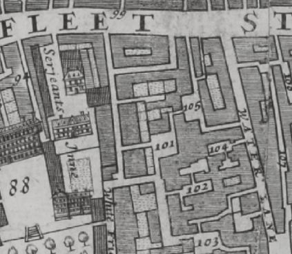
Water Lane off Fleet street in 1682 Morgans Map records 104 Black horse Inne and 105 Bolt & Tunn Inne.
This inn was recorded in 1682 and 1746 and is now long-demolished.
Historical London public houses, Taverns, Inns, Beer Houses and Hotels.

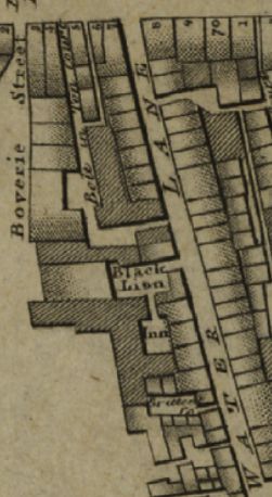
Water Lane in 1799 Rocques Map records the Black horse Inn and Bolt & Tunn Inn Court.
Historical London public houses, Taverns, Inns, Beer Houses and Hotels.

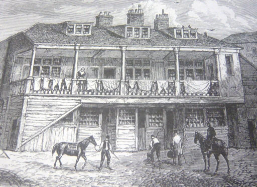
Black Lion, 10 Whitefriars Street, EC4 - an engraving showing the inn�s courtyard published in 1859
Kindly provided by Stephen Harris
Residents at this address
The 1682 Morgans Map records a '105 Bolt & Tunn Inne' in its index, which is in Water Lane.
In 1708 : A New View of London by Edward Hatton lists Bolt and Tun Inn, on the South sie of Fleet street, between White fryars and Water lane.
John Strype Survey of London in 1720 lists '69 Bolt and Tun Inn' - Farringdon Without Ward .
The 1745 Rocques Map records a 105 Bolt & Tunn Court and Inne, in Water Lane.
The 1799 Rocques Map records a 105 Bolt in Tun Court, in Water Lane running to Fleet street.
Trying to avoid privacy and cookie settings overwriting content