
Search london history from Roman times to modern day
The Bell Inn is immediately north of St Marys, Strand.
St Clement Danes pub history index

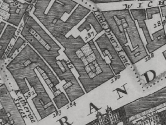
Morgans Map of London in 1682 shows Strand opposite Somerset house between Katherine street and Little Drury lane, and lists 282 Eagle & child Inne ; 284 Eagle Court ; 287 George Inne and 288 Bell Inne.
Historical London public houses, Taverns, Inns, Beer Houses and Hotels.
Residents at this address.
In the 1682 Morgans Map of London, Westminster, it is listed as '288 Bell Inne', in the Strand.
In 1708 : A New View of London by Edward Hatton lists Bell Inn, on the North side of the Strand near the end of Little Drury lane.
John Strype Survey of London in 1720 - The Parishes of St Clement Danes / St Mary Savoy lists '23 Bell Inn'.
In the 1756 John Rocques map of London, the Bell Inn is clearly marked immediately north of St Marys, Strand
In the 1799 John Rocques map of London, the Bell Inn is approximated to have been at 314 Strand.
Trying to avoid privacy and cookie settings overwriting content